

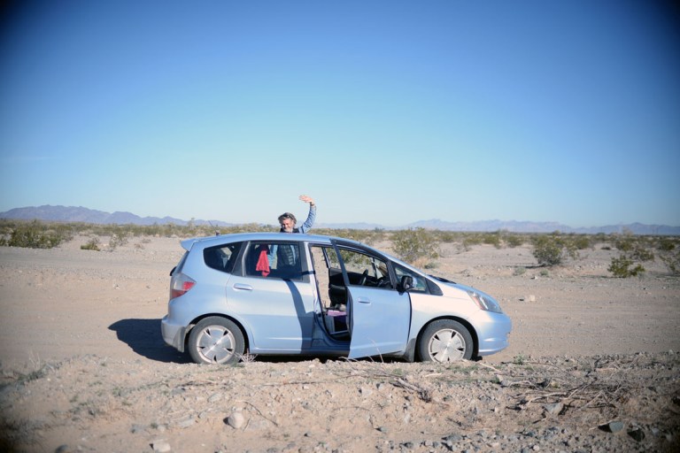

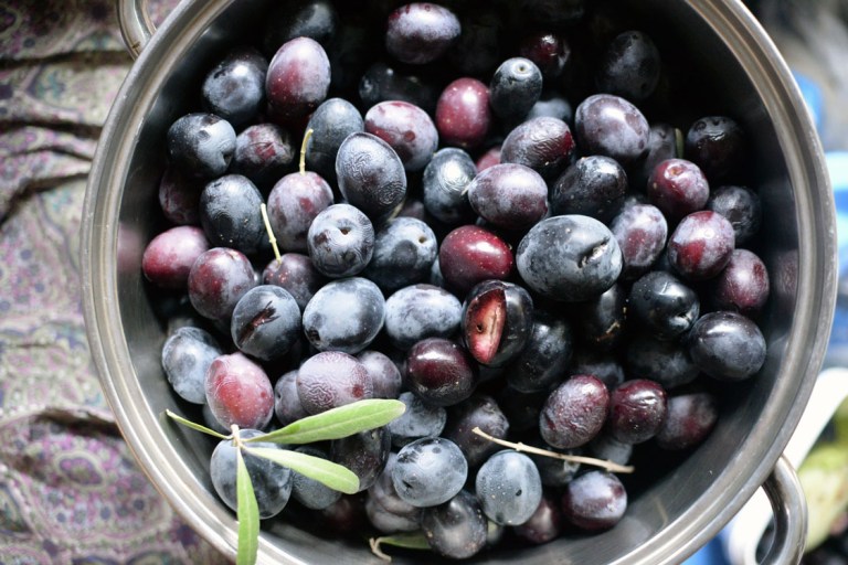
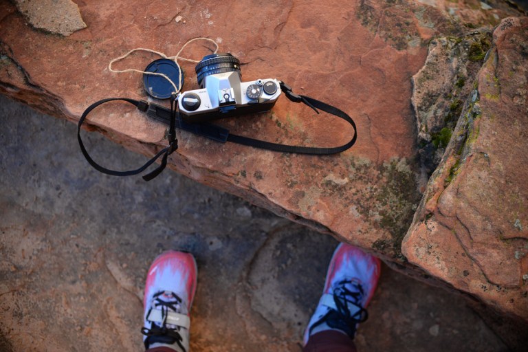
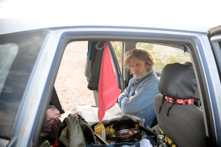
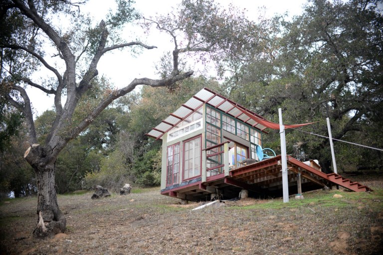
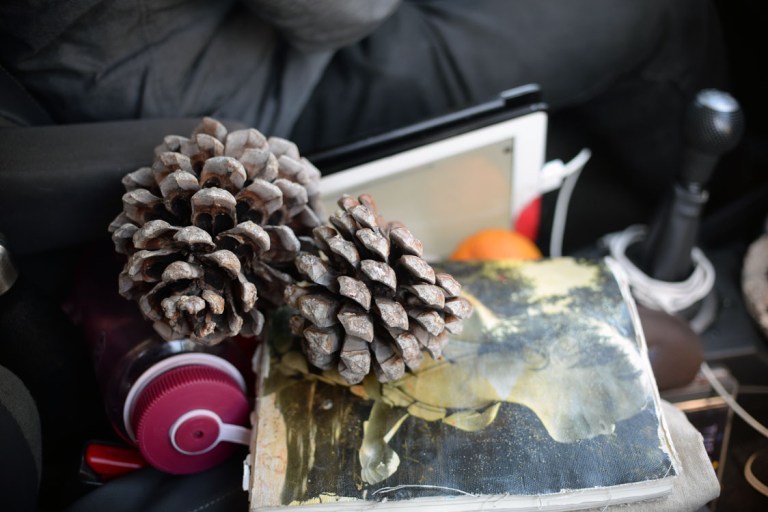
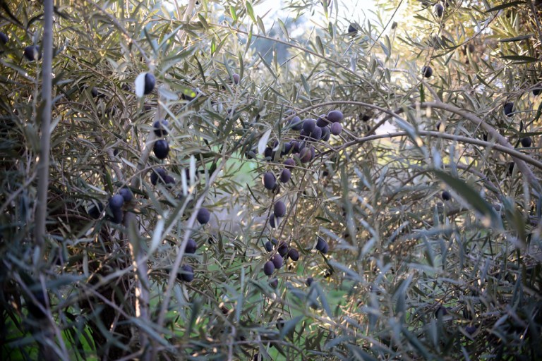
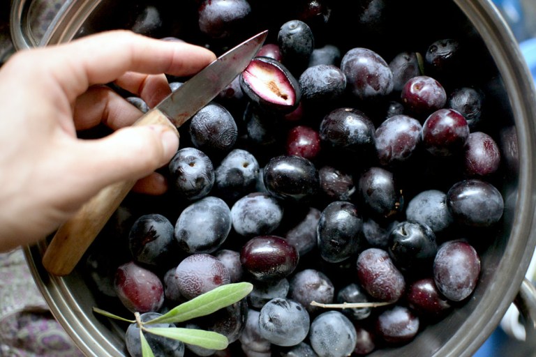
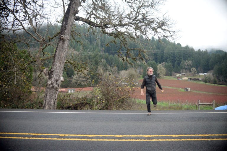
so the roadtrip is over folks. i’m sitting in the car on the ferry back to the big isle, editing photos. hall & oates is on the radio “every time you go away, you take a piece of me with you…” and i’m feeling sentimental. i love travelling, and i love going home (i really don’t like crossing international borders though, blah). johnny and i left the SF bay area friday morning for a wee trip up the coast. he accompanied me to salem, oregon, and then headed on back down to the bay area to spend time with his daughter and work for another few weeks. on our way north we stopped in a rest area he knew of that was carved out of an old olive orchard, and went to town picking. the olives were the perfect ripeness – so ripe they weren’t too bitter to eat uncured (well, marginally). this was super exciting for me as i’ve never seen a producing olive tree, much less picked an olive. we picked two bucketfuls that i am now bringing home with me for a crash course on curing. john filled his pockets and is bringing back a small tub to cure during his remaining time in california.
ok, how to sum up the past month? there was so much we experienced and so many places we went, but for often so short a time that the places could leave no imprint in me. i wish they would, but we will just have to go back one day. john is really good at going on trips down south, unlike me, who tends to head north, so i imagine time will be spent down there again soon. now as i sort through photos, poignant memories leap out and make me nostalgic already.
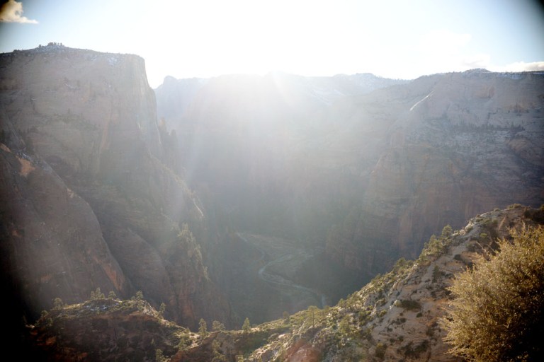
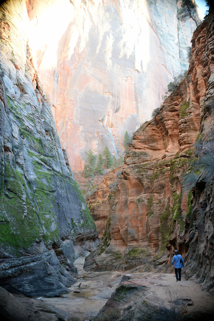
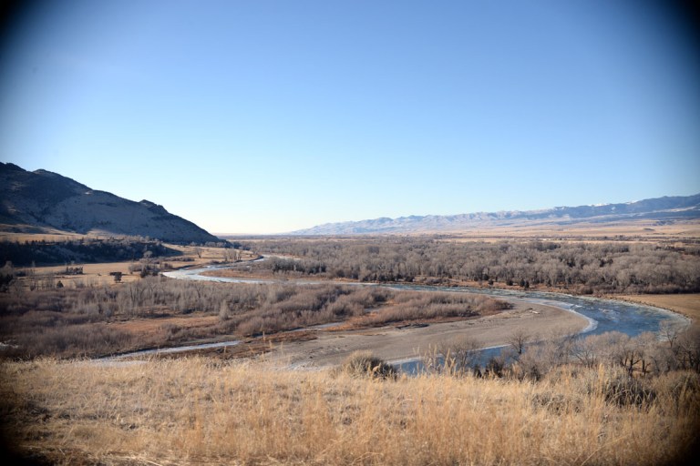
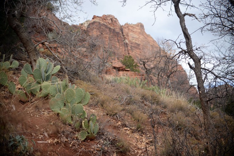
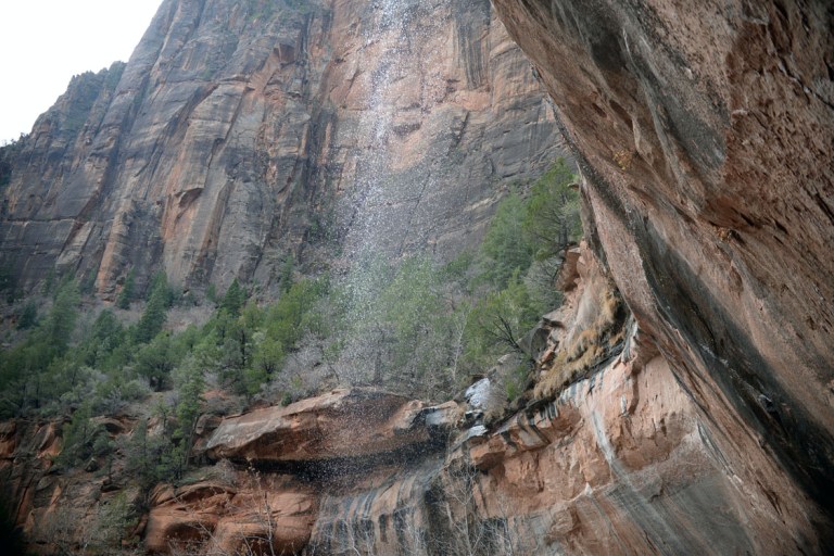
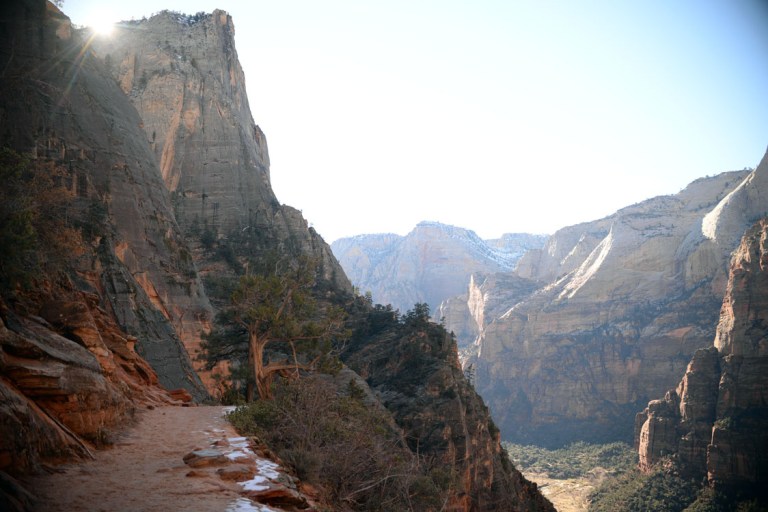
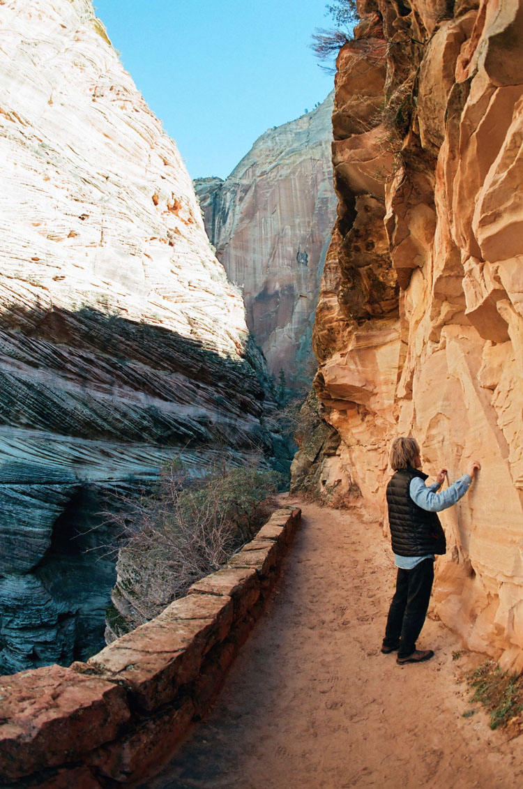
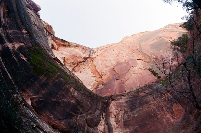
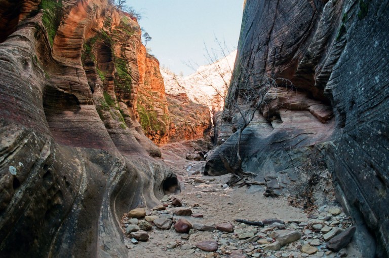
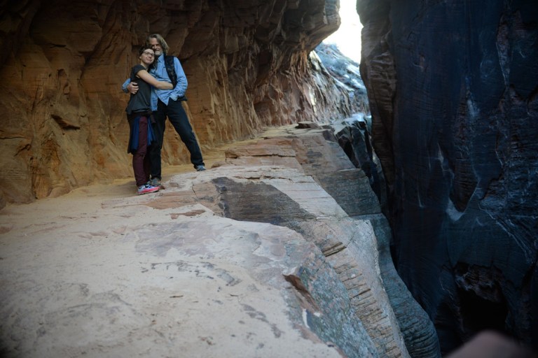
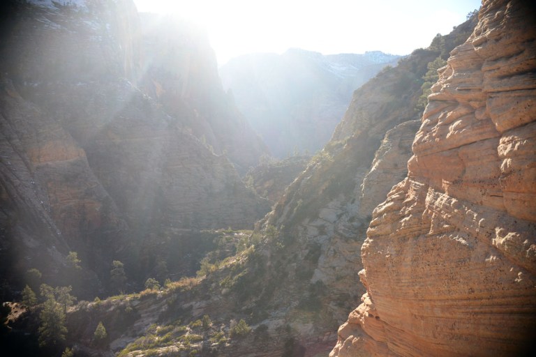
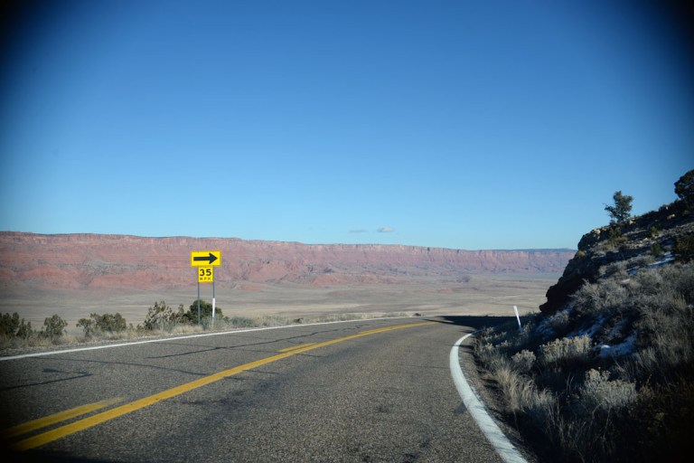
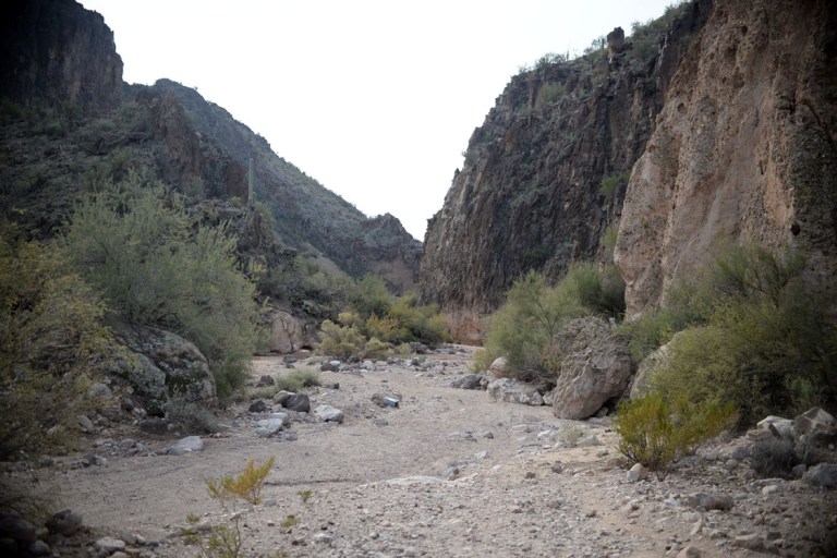
we went to zion, which i only caught a snippet of when i passed through the southwest in 2014. it is SO beautyfull there. it is definitely one of my favourite places in the southwest. as we were sitting on a park bench cooking up a lunch of broccoli and yams and eggs on the camp stove, we met a local woman named kate who told us that zion is her healing place. she has lived just outside the park for the last six years and comes hiking in it every day. can you imagine? i was glad to be there in the deep of winter. last time i passed through was mid-september, and even then there were long line-ups of cars through the park. this time of year was quiet, but still more people than i expected to see. we went on a couple of 45 minute hikes and then accidentally started heading up a 5 hour hike with only a few hours of daylight left. it got to the point where we kept thinking if we just turn the next corner we’ll see the view down the valley. each corner was such a tease! eventually we got close enough to the top that we were satisfied with the view and turned around to alternately run and walk down the mountain. that was fun.
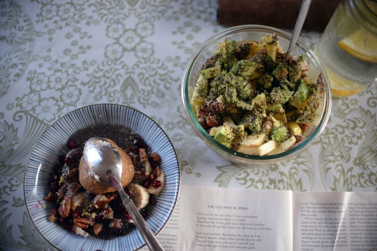
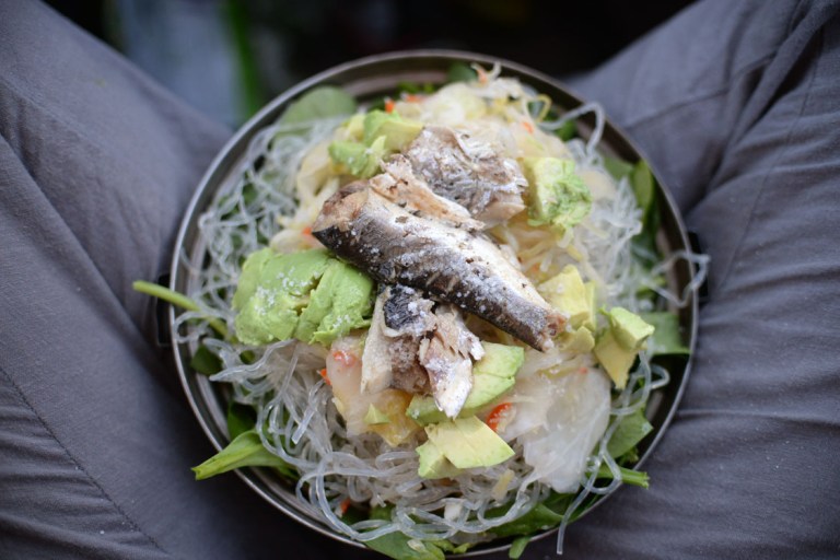
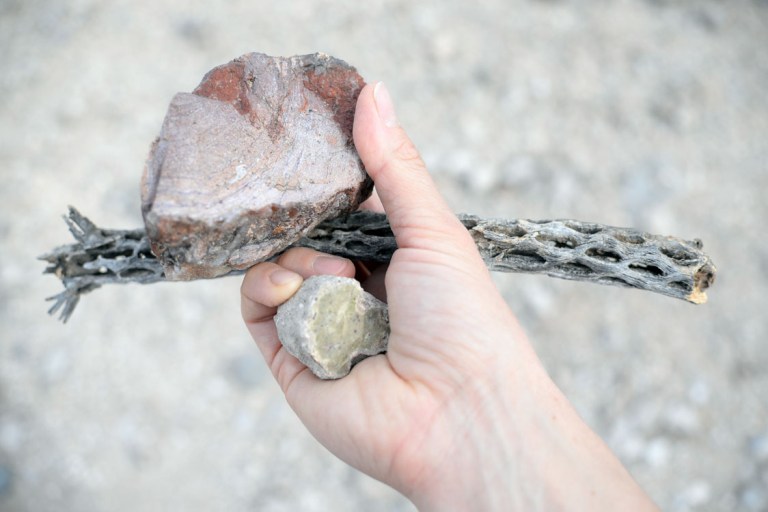
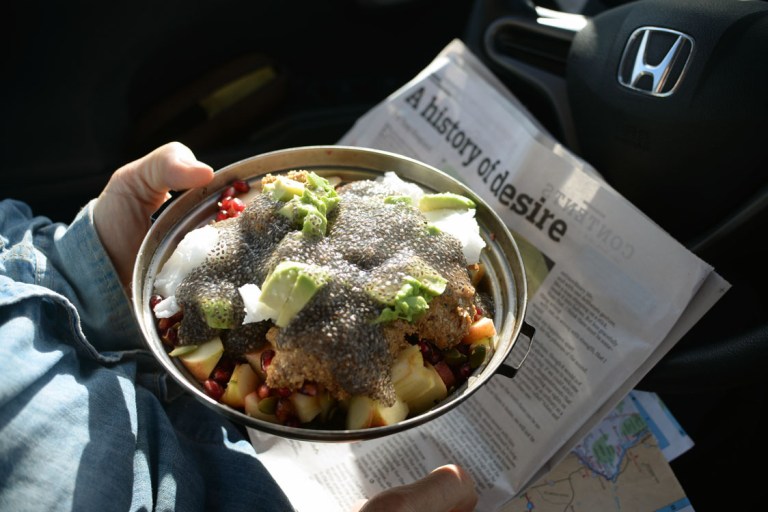
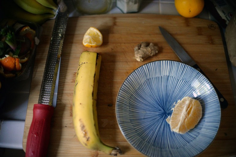
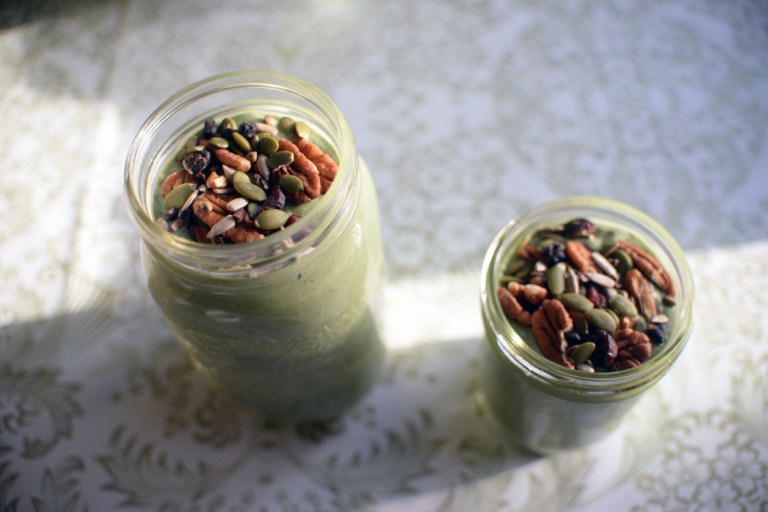
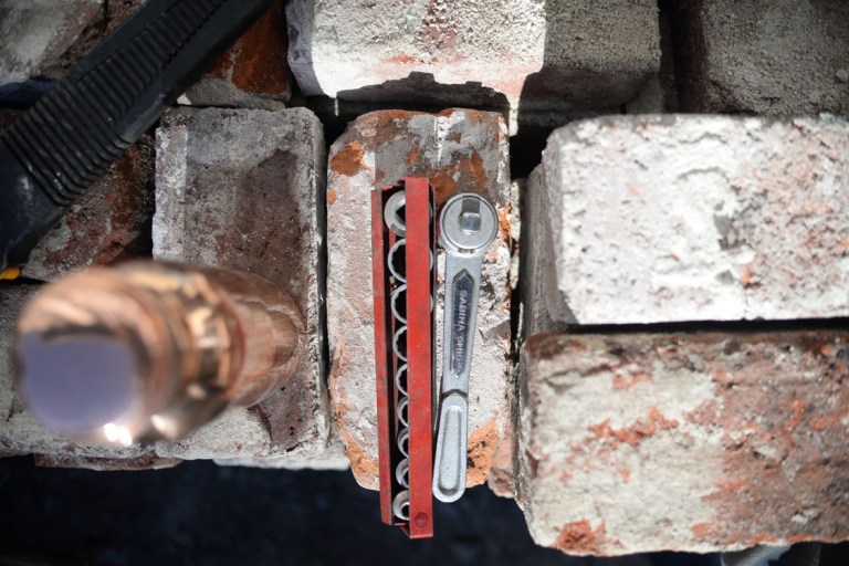
we seemed to focus on three main goals during the road-trip part of our adventure: thrift stores, health-food stores and hot-springs. our record in one day was four thrift-stores, often there were 2-3 per day. mainly we were looking for kitchen knives to remake into littler ones with wooden handles like the one johnny made me, but i also got distracted by sequin-y dresses. our health-food store kick was spurred on by a desire for mass quantities of cheap organic olive and coconut oil, and almond butter since we were no longer around johns almond butter maker, but it also got us on a sauerkraut bender. the first health-food store we found in whitefish montana had a delicious local kraut of cabbage, carrot, green apple and salt, which was INCREDIBLE. we unintentionally started a mainly raw food diet on the road, so krauts became one of our staples. after that first incredible kraut we started sampling krauts across the southwest, going for local when possible, and if not, just ones we had never seen before in canada. by the time we reached the bay area we had amassed a few favourites and tried making them ourselves. another favourite was by the company ‘pickled planet’ which had in it’s ingredients, along with the regular things, burdock, nettle, thyme, oregano, kale and lemon, YU-UM! another kind had smoked jalapeños and horseradish. we tried to stick mainly to the high-fat/low-carb diet on the road, and i feel we were somewhat successful. breakfast usually consisted of an apple and an avocado cut up and topped with almond butter, coconut oil, olive oil, salt, cinnamon, soaked chia, hemp seeds, pecans and pumpkin seeds. dinners would be spinach topped with another avocado, sauerkraut, olive oil, garlic, olives, nuts of various kinds, and sometimes sardines. we found this delicious uncured organic beef sausage in flagstaff that we immediately regretted not buying more of. based out of wisconsin, i’m wondering if the further south we got, the less likely we were to encounter them. we finally found them again on the trip north, two great stores in oregon had them. we stocked up!


ok, it’s a couple of weeks later and i am on the ferry home to the wee island, the mountains of van isle are silhouetted in the distance, the lights of town glitter and glow as i head steadfastly to the isle of wintry darkness. the sea calm, the ferry nearly empty, a perfect time to write. i am hoping to get most of this written now, so let’s start with hot-springs!
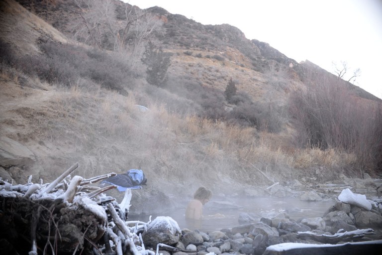
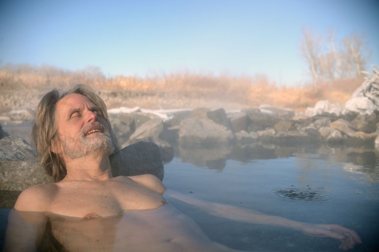
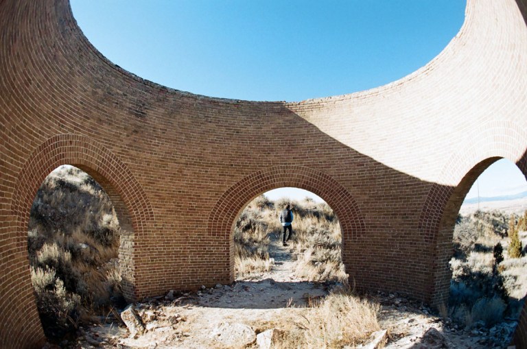
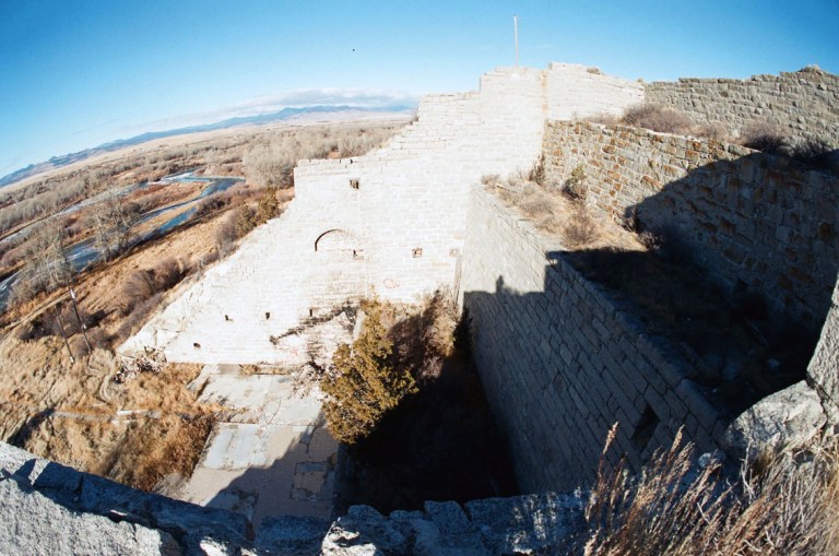
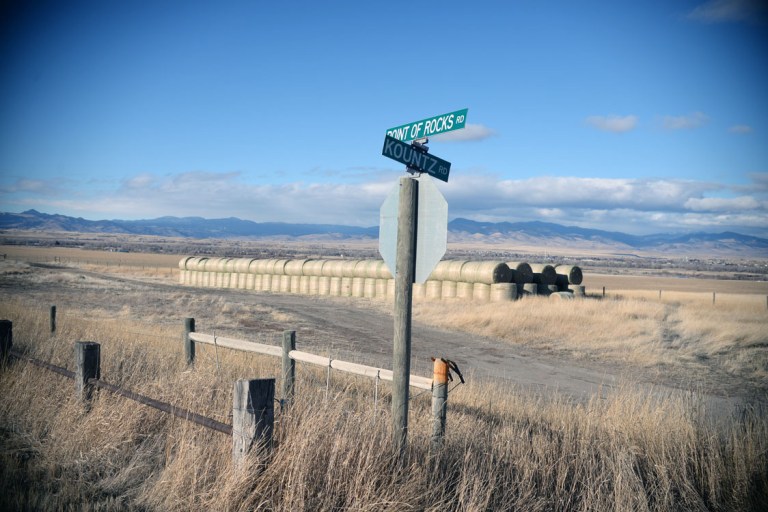
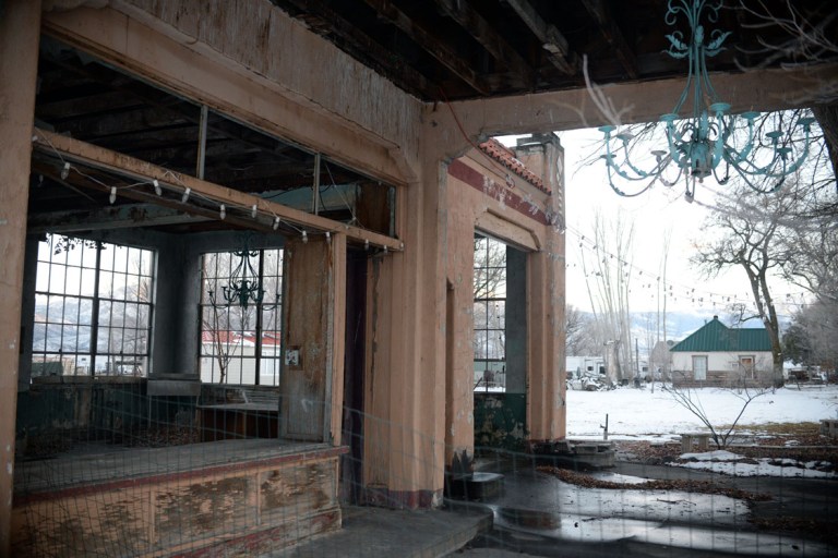
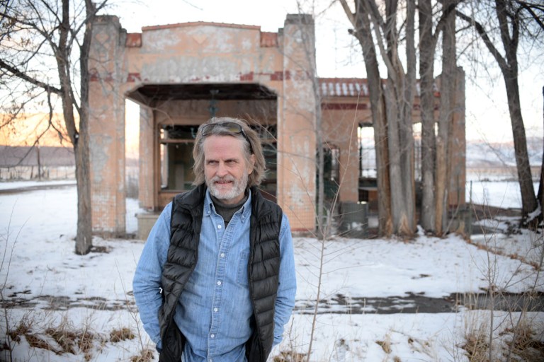
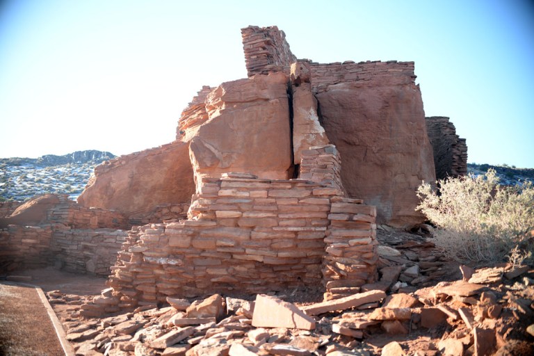
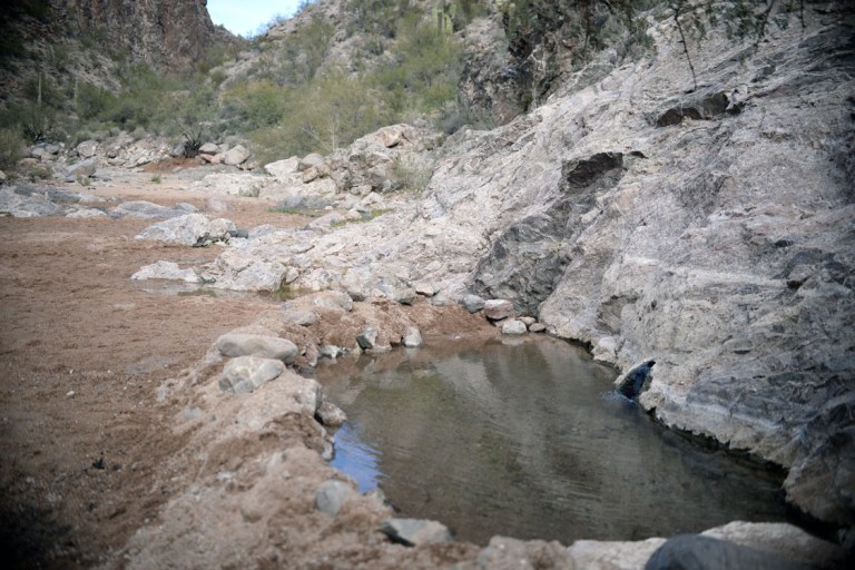
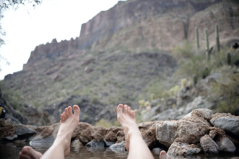
we were looking for free and natural ones. we began our trip in golden, as you may recall from the first adventure post, which was mainly to see my dear friends, but also to get ourselves down to yellowstone, which i intended to visit in 2014, but had to bypass at the time. yellowstone being famous for geysers was sure to have hot-springs. problem was, they close all the roads into yellowstone for the winter, except for the one that skims the top of the state of wyoming, heading from west to east, which we surely didn’t want to take considering our direction was south. especially after our first night on the road: it was about -15 overnight and we were camping in the car. cold!!! after that night we generally felt like hightailing it south to warmer climes. john is not one for warming up vehicles, he staunchly insists it is unnecessary for the health of the vehicle and detrimental to the environment. he is so adamant on his stance that at any possible opportunity he shuts the engine off: going down hills, at traffic lights… and one of his favourite activities is monitoring and reporting on how many L/100km of petrol we are using (the car has a gauge for this). all that to say, after this -15 morning, where our breath had fogged up and frozen on the inside of the car windows before we fell asleep, he only VERY begrudgingly agreed to let the car warm up for five minutes. the five minutes cleared up two horizontal ovals at the bottom of the windshield and that was about it. to prolong the time the car warmed up after this, i decided to run to the end of the rest area as john slowly drove to catch up with me (also for exercise: spending hours in a car does the opposite of wonders for ones back). after this i took the scraper to the inside of the windows to remove the remaining ice as i best i could and off we went. AN HOUR later the inside of several of the windows were still frozen, the air going by at 100km/hr outside still being so frigid as to override the blasting heat inside. we eventually pulled into a tiny montanan town called whitehills for gas, and as johnny went inside to enquire about local hot-springs, i peeled our two frozen bananas and made them into a delicious sort of ice-cream with almond butter, yu-um. the perhaps one perk of our freezing evening. john came back reporting that there were local springs about 12 miles away. the directions were: turn right at the mechanics, turn left at the stop sign, follow the road until the T intersection and then turn right. it will be along the river, you can’t miss it. well, you know what happens when you get directions like that. you insert your own understanding of things. plus, we weren’t sure when the 12 miles started: from the stop sign? from the T intersection? off we went. the stop sign was no problem. but then the road started winding and turning and there were several places where i thought, was THAT a T intersection? we kept going though, at least enjoying the drive through beautyfull rolling ranch land. at one point we passed this cool cylindrical brick structure with no roof and arched doorways where we thought ‘wow! we have to stop there on the way back!’. on and on we went, the road wound about, but a river was coming closer and closer so we held out hope. and then there it was, steam rising out of the frozen river at the bottom of a hill. these springs were well known locally and had been built into several small pools one could lounge in, the cooler of them even being cemented. we chose the hottest, which had bubbles of boiling water rising up from the bottom. despite the air being below freezing, there were definitely spots we could not sit in, and we ended up looking like lobsters just several minutes in. of the three hot-springs we made it to on the trip, this one was the best for heat combined with locale. only one car drove by as we sat there indulging after our cold night. on the drive back we did indeed stop at the ruin. as i was taking photos of it, john wandered over the little hill to what was the top of the same river valley and said, “you’re not going to believe this”. instant spark of excitement! as i crested the hill, i marvelled. whaaaat? cut out of the hillside were the ruins of what appeared to be at one point a five storey building. but what sort of building? it had two weird tiers that i thought maybe used to be wading pools, and then a main floor at the bottom that opened out towards the river. at the bottom there was a tile floor in one section, and a cement sidewalk down to the river. to one side of it was a hose and an area that looked like it used to have water flowing through. all of this made me think it related to hot-springs somehow, that maybe at some point they had diverted some springs and made a dance and bathing hall? it was a very romantic notion on my part, turned out. a few days later, with some research and internet connectivity, we discovered that it was the beginnings of a copper smelter that never actually got off the ground. a man named Jared E. Gaylord instigated building it near the end of the 1800’s, but by the time it was completed the Amalgamated Copper Co took over and relocated, leaving these curious relics behind. apparently they couldn’t use any of the equipment either, so a few a few years later it was sold for scrap. wow. one of the most exciting parts of the ruins was a low arched brick tunnel that extended back into the hillside about 30m before it had either collapsed or was filled in. this was up in the side of the third tier. despite knowing what it was meant to be, i am still so curious about it. what was the tunnel for? and the tiers? how does a smelter work? the brick cylinder at the top was apparently the kiln, so maybe molten copper flowed out of there and into the tunnel and then through the tiers? anyone know the answer to this?


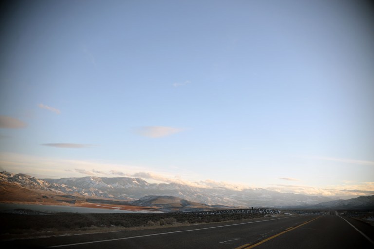
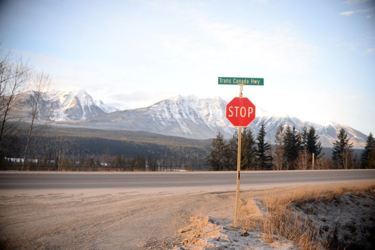
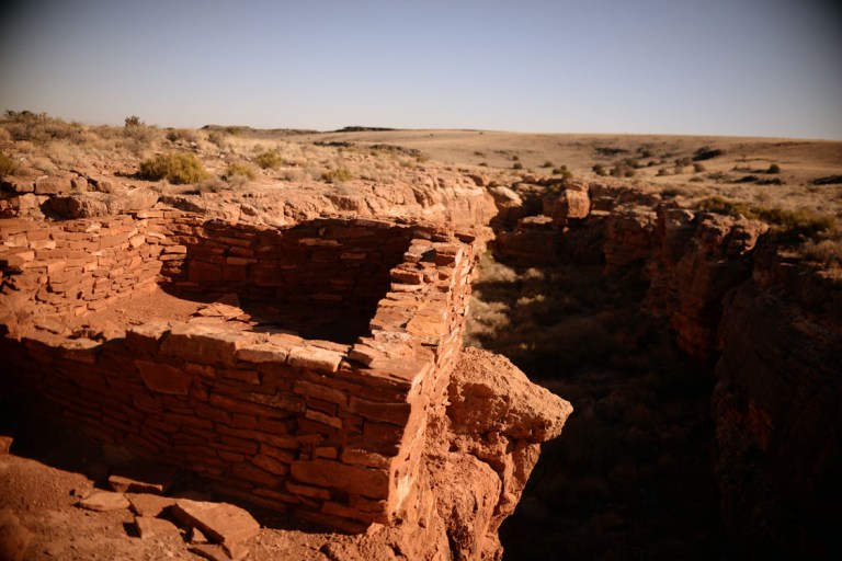
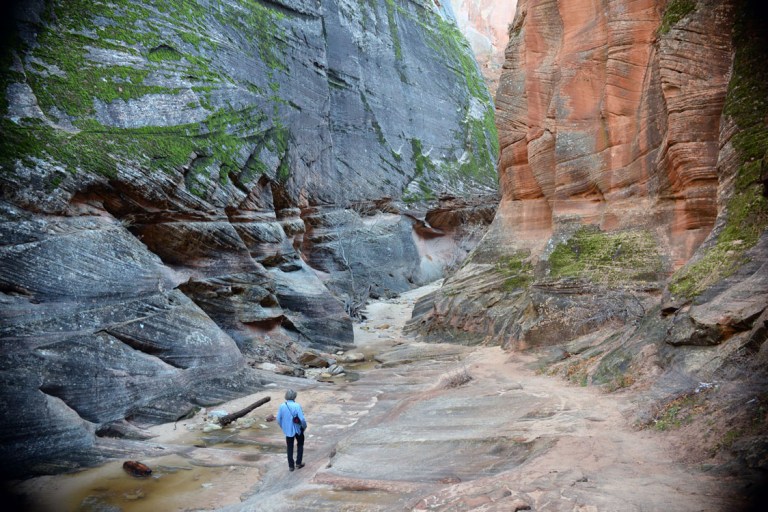
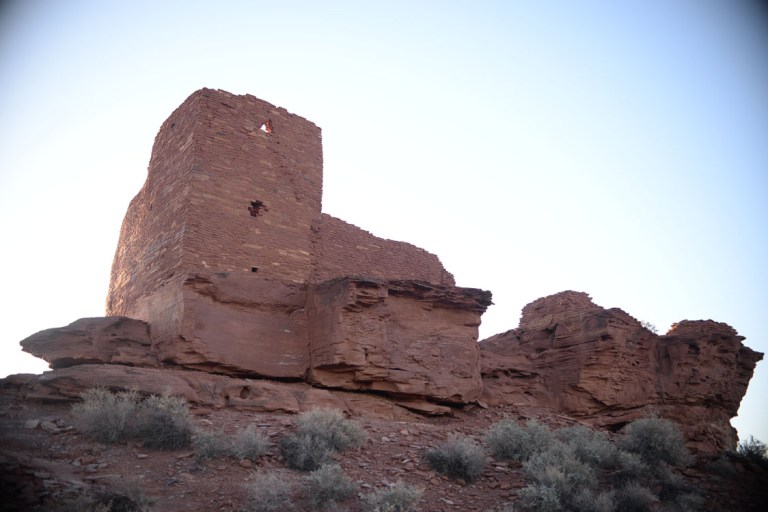
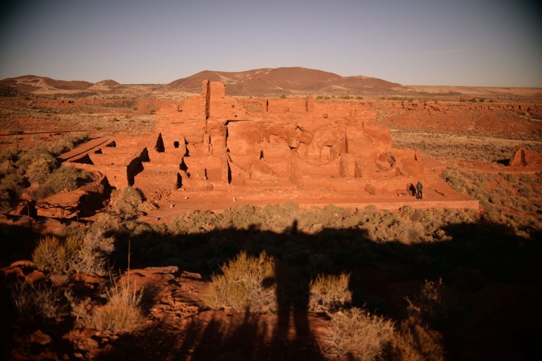
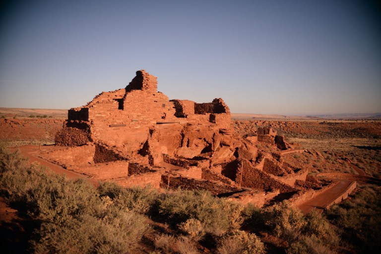
after the excitement of the morning, and freezing our wet hair while examining the smelter ruins, we headed onwards south south south. that night we drove on until past 11 trying to get somewhere warm, and with no luck finding the rest area we were looking for, we settled on a walmart parking lot near salt lake city, utah. though there was still old snow on the ground, we were much warmer that night. near the beginning of the trip our go-to’s for sleeping were rest-areas and walmart parking lots. both free, and walmart had wifi. later in the trip when we got more used to things we’d find out of the way places to park that we imagined would have little to no traffic. after several of those it was hard to submit to going back to the noise of rest-areas near interstates. the next night we made it to near zion and pulled over to stay in a quiet rest area on hwy 89, which was the first of the great camp-spots, surrounded by snow-covered trees and darkness and stars. we spent all the next day in zion and then stayed at the walmart lot in the nearby town of hurricane to use wifi again and to head back to zion the next day to check out some ruins we didn’t make it to on day one. we started at the visitor centre to ask where the trail leading to the ruins were, but the man working there said there wasn’t much left, the archaeologists had excavated, pulled some artifacts out and then re-buried everything, so all we could really glean from visiting was the beauty in the placement of the site they chose. this man had been living near zion for 30 years – he and his wife moved out there from L.A. to get away from the crowds. we unfortunately didn’t get his name, but he worked for the park for 18 years and was now in his 13th year of volunteering. he was 95 years old and sure didn’t seem it! the irony now, he said, is that the park gets another 1000 visitors every year, but he is done with moving, they are just going it stick it out there. if we were interested in ruins he suggested we go to the wupatki ruins in arizona. that was all the impetus we needed – off we went.


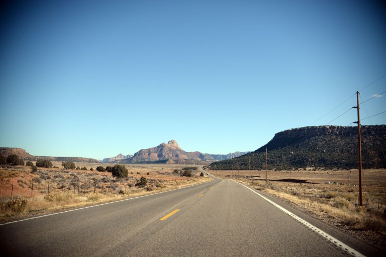
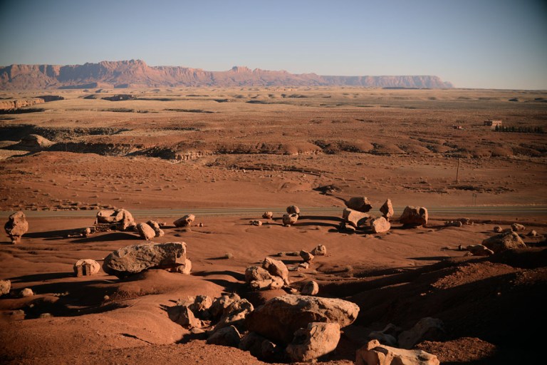
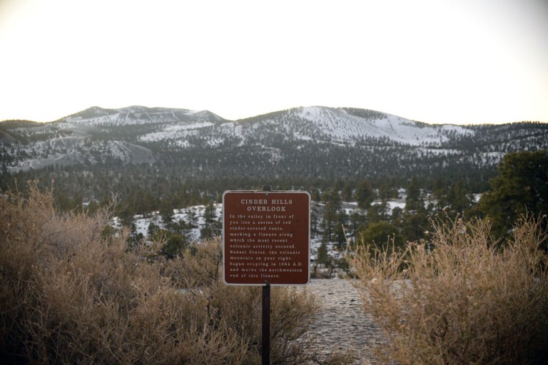
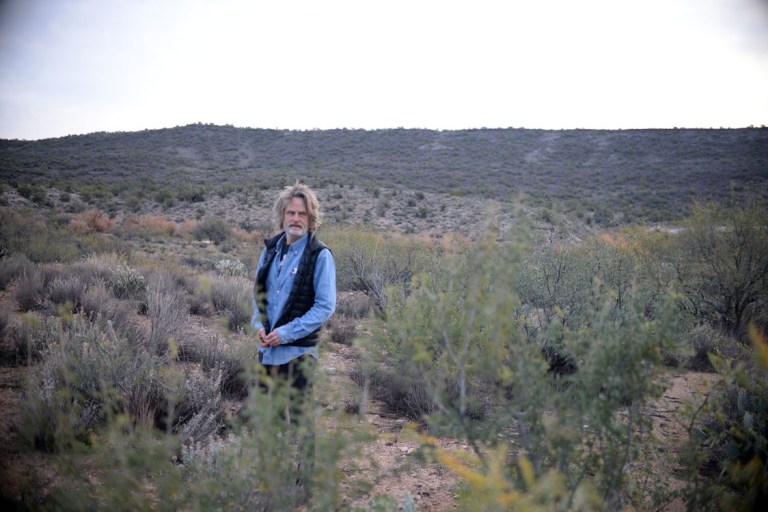
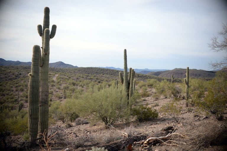
arizona is such beautyfull country, everywhere you look, beauty. on our way to wupatki we stopped at cliff dwellers, a town south, as the crow flies, down the colorado river from glen canyon. the red earth and late-day mid-winter sun just made for magnificent photographs. on the side of the highway near cliff dwellers were newer ruins built by the navajo for pioneers around the late 1800’s. we made it to wupatki near dusk and i felt we wouldn’t have enough time to get through everything before darkness hit, so we decided to come back in the morning. that night we camped in a viewpoint pull-out in coconino nat’l forest. it was the cinder hills overlook at sunset crater, a volcano that had erupted in 1064. one of the great things about sleeping in the car and spending most of our non-car time outdoors, is that we never went to bed too late. it got dark, and we had nowhere we needed to get to, so we pulled over to the nearest hospitable place in order not to miss the scenery. this had us going to bed by nine each night at the latest, and rising with the light. when we awoke in the morning we discovered the beauty of our surroundings, then headed on toward wupatki. we arrived as the sun was rising, but holy shit was it cold! we were in the freezing temperatures again, requiring mittens. the first ruin we went to was silent, no one else about, so we could wander and marvel in silence. the people of wupatki seemed to have settled here for a little while after the volcano erupted, most likely when the soil was fertile from all of the ash. they had this marvellous way of building that would incorporate the natural rock as walls and floors and then build onto it with slices of other rock found nearby. they would also build on natural rises in the land, commanding views. we visited three different ruins here, but there were still more. the main one was like a little village, with a couple of ball courts and a large multi-roomed house. the whole place was fascinating, but there was something else too: a blowhole. i had never heard of these, it was a natural hole in the ground accessing an underground passage of apparently unknown extent. these blowholes existed in a couple of places throughout the park, but they didn’t seem too interested in telling me where else. when the outside air pressure rises, air is driven into the blowhole, and when it is lower, air is pushed back out. the park had put a grate over it, but you could still stand there and hear the muted roar and feel the air move. wo-ow.


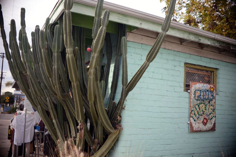
after wupatki we continued our health-food and thrift store kick, stopping in flagstaff in one of the best health-food stores we found in terms of price and satisfaction: cheap avocados and kraut and apples! and this is where we first found those delicious uncured beef sausages we later searched everywhere for. after flagstaff we drove through an INCREDIBLY scenic oak & pine & juniper river valley bottom on our way to sedona. wow was it picturesque with concrete roads crossing the river so low they had water flowing over them. i could’ve spent more time there. the road emerged out into cute little sedona where we hit another thrift store and where the belief in spirituality of place is so strong and pervasive that the man at the visitor centre suggested several “vortexes” for us to visit. it was really warm that far south, and therefore very touristy, so we didn’t stick around that long but did view one of these vortexes from afar. our mission for the next day was to find kaiser warm springs so we pulled over on a side-road highway after dark to hunker down for the night. as we were driving down this highway a couple of hours past sunset i thought i saw a tall hulking silhouette of cactus, but it was so dark it was hard to be sure…until we saw another one closer to the road. saguaros!!! we were in saguaro country! john was hoping we were going to be driving through saguaros, but we weren’t going to be going through the places he had seen them prior, so he wasn’t sure if we would make it to their terrain. i am so glad we did, they are SO cool, and the next morning we realized we were in a virtual forest of them! but back to that night, when we finally stopped and got out of the car, it smelt phenomenal, like earth and green and the ground giving up the heat it held during the day, and i saw my second shooting star – two nights in a row!
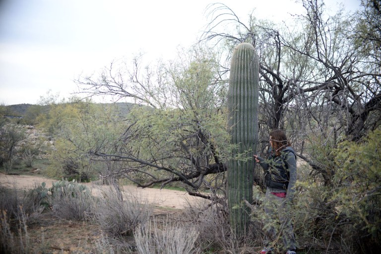
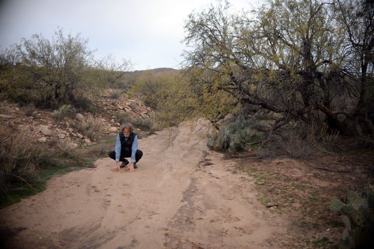

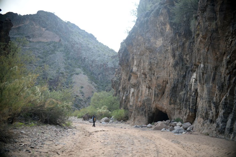
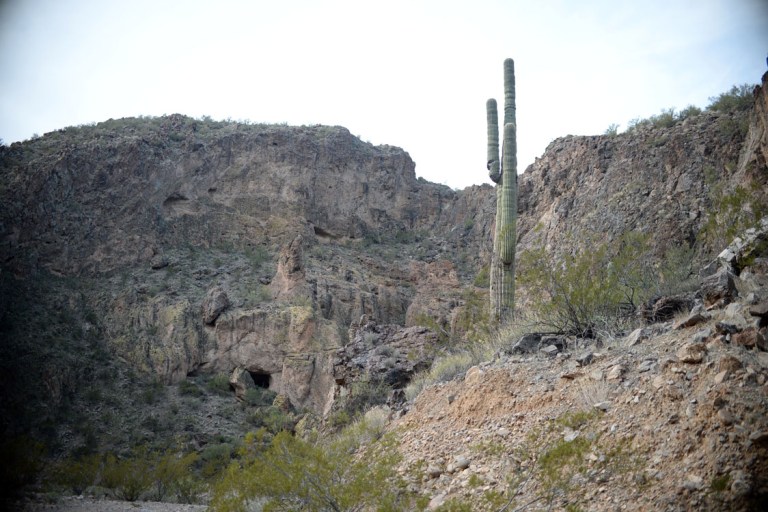
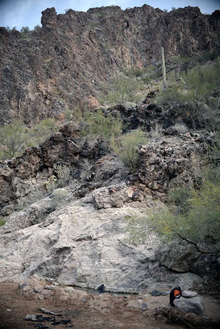
the next morning driving through rocky saguaro land we went on our next wild-goose chase to find another hot-spring. my oversight in choosing this one was that it was just a WARM spring, had i clued in to that we probably wouldn’t have gone off in search of it, but i am so glad for that oversight because this was the spring that was #1 for scenery. the vague directions we found on the internet said to turn off the highway at the first road on the left past the giant bridge, take a left at the first Y and follow it til you couldn’t follow it anymore, then continue on foot. our first mistake was not realizing there were TWO giant bridges, one shortly after the other (what are the chances?). we took the gnarly gravel road down to a river bottom that turned out had a campground in it. john got out to ask for directions and discovered there was another bridge further down the highway, which was the one we were supposed to turn left off of. they also advised us not to try to head back to the highway on the nearly impassable gravel road north of the river, there was an easily navigable paved one on this side. too late, he said. so we tried again, and found the road easily, just where the directions said it would be, past the bridge on the left. this gravel road however started off looking like it was in NO way passable with a little honda fit, being steep AND deeply rutted AND lined with spiky tire-flattening cacti. but, johnny being johnny, he wanted to give it a go. i refused to let him drive it up, so i took it on, with him walking outside to guide the way and remove rocks if necessary. after several loud clunks and spinning of the tires i stood my ground and backed it down the hill. donning packs we left the car and headed out into the desert. it was an interesting landscape in that you could see across it for miles – undulating low hills and occasional roads winding throughout. we followed the directions as best we could, but eventually it seemed like the road was doubling back on itself and about to reconnect. this led john to believe that when we attempted a return to the car, we should just head cross-country and ditch the roads. luckily the road didn’t end up doubling back, but led us into the beginning of a canyon. this is one of the ways in which i find the desert phenomenal: you are walking along, able to see so much land spread out before you, nowhere do you see anything that could be a canyon, but what seems like all of a sudden, you are at the edge of one. or in one, as was the case this time. how can something so seemingly flat with no cover, harbour something so large? we seemed to have entered the beginnings of this canyon at a low point on one of its edges. its sides quickly rose until we were in a deep steep-sided chasm, which we were later to find out was called the kaiser springs wash (another thing i love about deserts: washes). it was a canyon that filled only in monsoon season, at that point it was dry sand and rocks. we kept walking and walking, at this point we were probably about 45 minutes in, and john would every so often comment, “this is as far as you could drive to, now we would proceed on foot”, but then a little while later we’d see tire tracks or he would think it passable again. on and on we wound through this canyon, saguaros and ocotillos and other cacti i didn’t know the names of lining the walls. every now and then a shallow cave. we were fairly certain by the point we entered the canyon that we were on the right track, and then almost an hour into the hike, we saw a bit of water on the wash bottom. then, there it was: a bathtub deep pool, big enough to comfortably hold maybe four people, built from rocks and sand, only designed to last until the rains came again. the water here was spouting out of a hole about the size of a finger, a couple of feet off the floor of the canyon. it was indeed only a warm spring, just hot enough to keep us comfortable on this arizona winter day, but it was good to get clean and lounge and the hike and scenery were so beautyfull. on the way back we tried johnny’s way of heading out cross-country, which led to finding better rocks and more interesting scenery, but in the end had us paralleling the highway for the last half hour of walking. turned out it wasn’t as obvious as we thought.

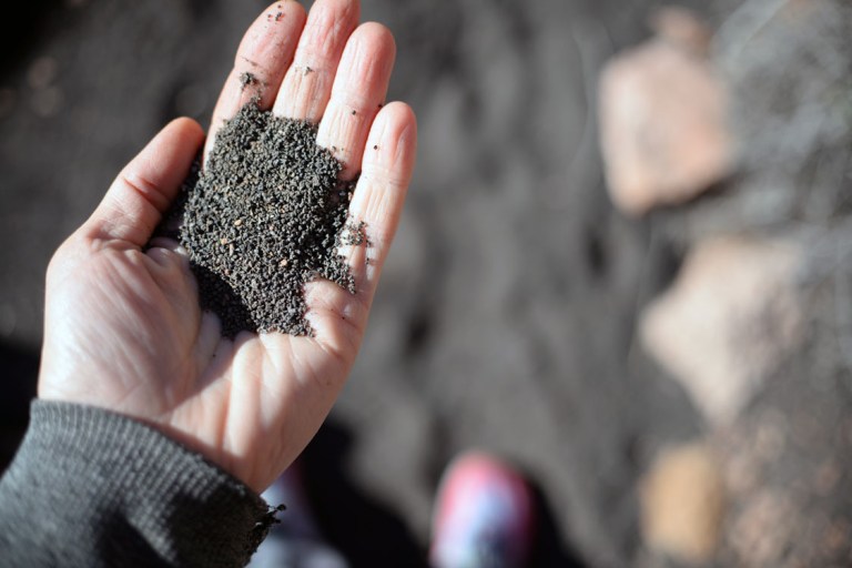
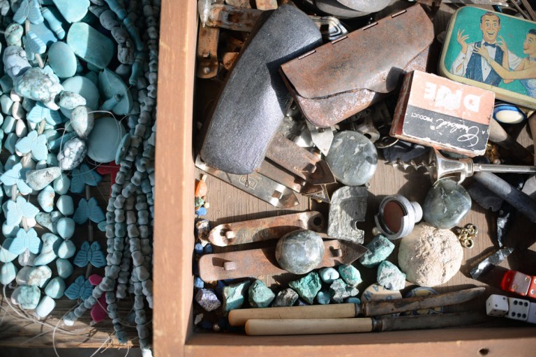
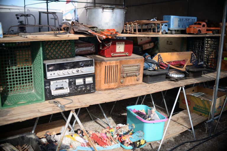
that night we made it to a BLM campground near the town of quartzite, which we planned to explore the next morning. this was our first and only free campground, and it wasn’t a campground so much as a big empty space in the desert where one was allowed to park for as long as two weeks before moving on. quartzite was a weird town, it seemed to exist solely for the giant outdoor flea market it housed. i was excited to visit the town beforehand, because it was supposed to be a good town for rocks, and it’s true that all the stalls sold rocks of many kinds. the first stall we went to was great, the prices were reasonable and the stuff was exciting and old and somewhat fascinating, but the subsequent stalls became wearisome in their sameness, with many selling cheap goods for too-high prices. i was glad to leave and that night we camped just inside the california border at a rest stop near blythe. the following day our goals were many, we wanted to find holtville hot-springs on dads recommendation, and also check out the salton sea and possibly make it to borrego springs, because johnny knew we could camp there for free. we started the day by attempting to take a back-road short-cut back to the main highway heading south. this short-cut, as they sometimes tend to go, was not a short-cut. it quickly deteriorated into a rough road, strewn with ruts and small-mammal-sized boulders, most certainly unnavigable by anything less than a 4×4 with lots of clearance. again, johnny being johnny, he wanted to continue, and the excitable adventurous part of me relented, despite having two-gravel-roads prior stated adamantly – “NO MORE GRAVEL ROADS”. well, this one was definitely the last one. the scenery was gorgeous and we met no one, but as we crawled along at 30k/hr my stress level was so high i could barely enjoy it. the emergence from this desert road into a belt of green was my shocking introduction to the imperial valley: this large swath of desert land irrigated by the dwindling waters of the colorado river to produce year-round crops for the rest of the continent. i wasn’t a fan of the imperial valley, it was just conscience-crushing.
with the regular somewhat misleading information from google, we found holtville hot-springs, a mecca for the snowbird community. if memory serves me well, i believe it was built during the second world war, but that is about all i remember. it consisted of two small concrete pools, and a shower, and was kept clean and maintained by the caretakers of the nearby camping area. the fenced area was surrounded by a thick wall of palm trees fed by the spring water – a little oasis – which did its job very well as the springs were within sight of the highway. the underground spring was piped into and spewed out of the pipe which was both a shower and the pipe feeding the pools. these springs were HOT, i stayed in too long and emerged light headed. whoops. after the springs we drove through the cute little town of el centro. at one point this town seemed like it must have been incredibly prosperous with a very large outdoor central square and ornate buildings that used to house much more than they do now. also, like many of the small towns we passed through, this one had a charming little movie theatre. i think next road trip might have to include stopping in all of these adorable theatres we pass by, or at least a couple… the next town we passed through after el centro was westmoreland, which probably would not have stuck out to either of us, except that it had a store with a giant sign that read LOCAL OLIVE OIL. stop we did. in the end we didn’t buy the local stuff, but the syrian olive oil that the syrian proprietor recommended as his favourite. he and his family had moved there from syria and now had a date farm. his son was working the shop with him and they had a fine selection of many varieties of dates, and free samples! staying away from sugar, i limited myself to trying two different kinds, but it was sure difficult not to buy any as their prices were so good. in the end the kind man gave us a small tub of the chili covered date slices i was drooling over. i was glad it was a small tub because they were very hard to stop eating, but oh so divine on our avocado/kraut/pecan/spinach dinners. we made it to salton city on the salton sea shortly after dusk, so i didn’t get to see it in all its wild splendour, but i got the gist of the ghost city. i also got the gist of the receding shoreline of the lake, especially with the ridges of fish bones/barnacle bits that formed bathtub rings in the sand at places that the shoreline had rested for awhile. wild.

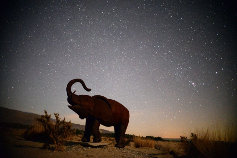
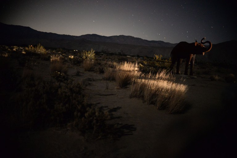
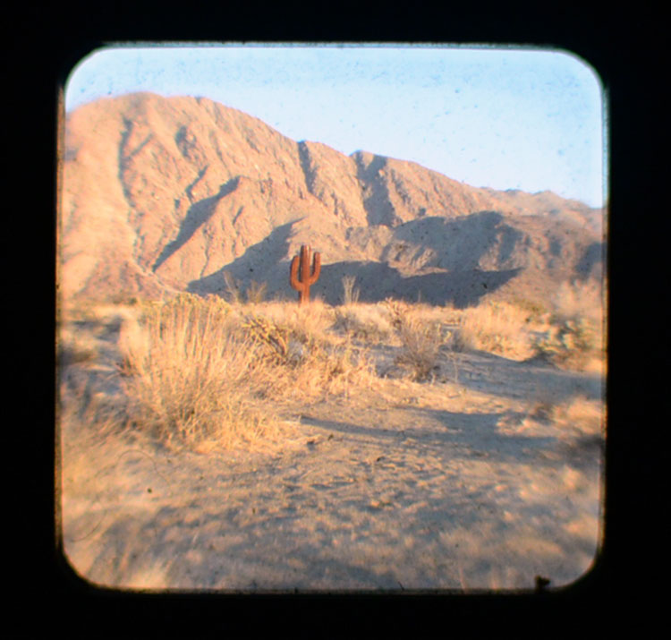
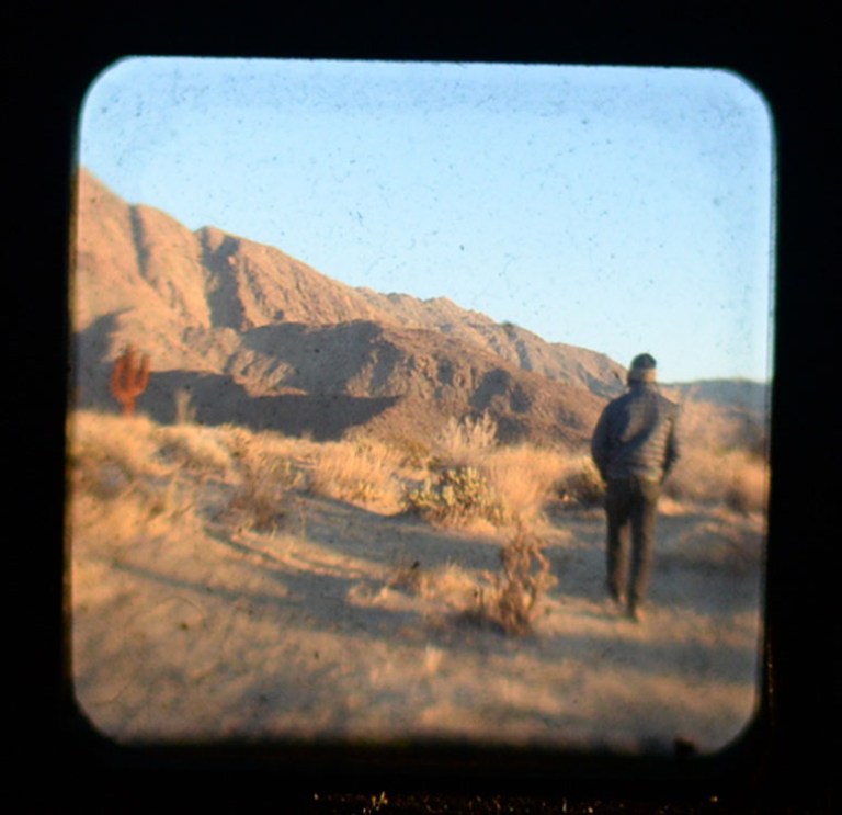
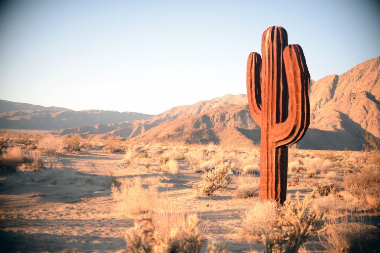
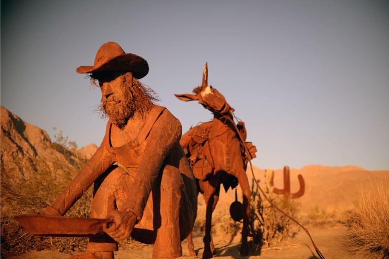
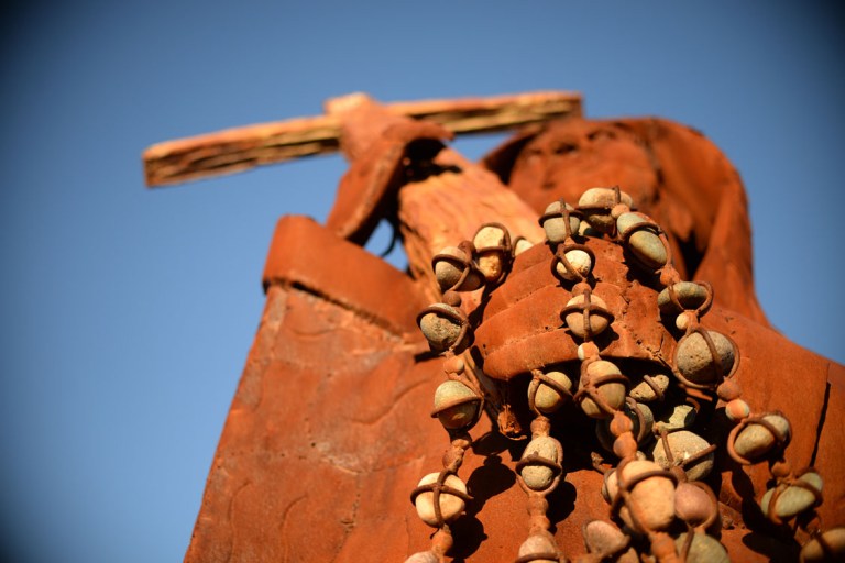
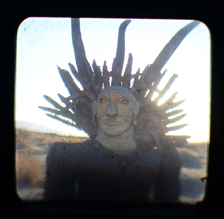
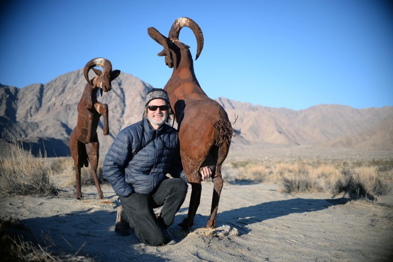
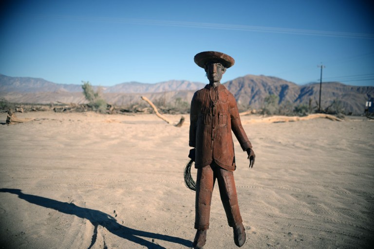
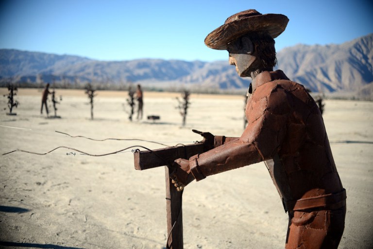
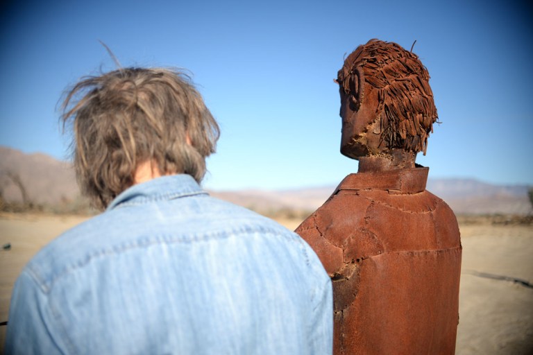
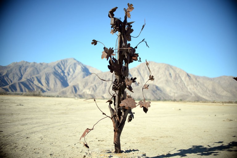
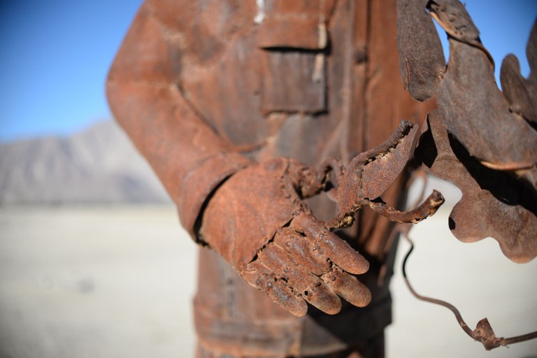
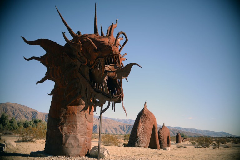
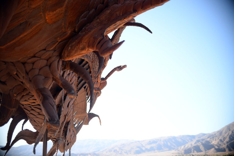
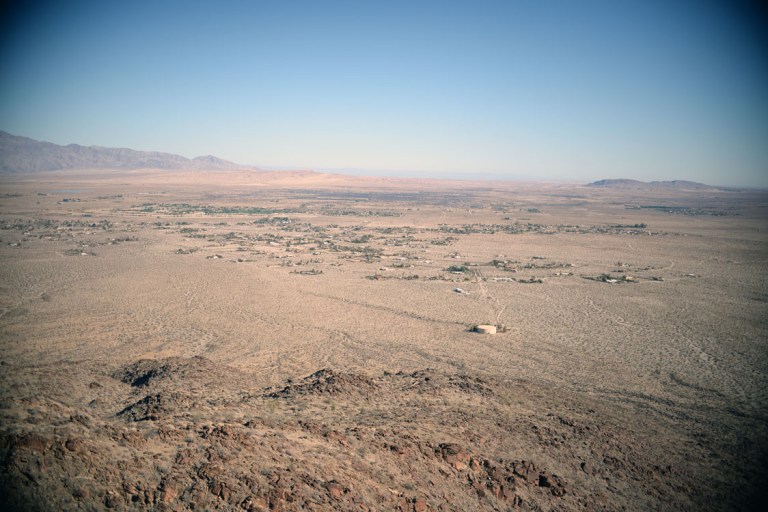
onward we headed towards borrego. we did find the area that john knew as free camping, except camping wasn’t allowed there anymore. with a bit of driving around in the dark we eventually settled on what we thought would be a fine place to camp, a little ways off the road into the desert scrub. it turned out to be the sweetest spot yet. it was absolutely still and silent and right before turning in we heard the yipping and barking of a very nearby pack of coyotes. we had also spotted three a few days prior, on our way back to the main highway after the kaiser adventure. borrego springs is on the flat bottom of the desert, surrounded by a U of mountains, giving it a cozy feeling somehow. waking up the next morning, the sun rose in from the opening of the U, painting the backdrop of mountains and the varying cacti a glowing vermilion. we were camped in a vast area called galleta meadows owned originally by dennis avery, who commissioned ricardo breceda to create rusted metal sculptures of the fantastic or prehistoric, which were strewn about the land and were all quite fascinating and phenomenal to behold. borrego springs ended up being one of my favourite places that we stayed, the land had a peace and stillness to it. there was an intricacy in its desert life that i would like to spend more time with and the hiking seemed like it could be beautyfull. it was already what i considered hot in december, so i don’t think i’d want to come back at any other time.


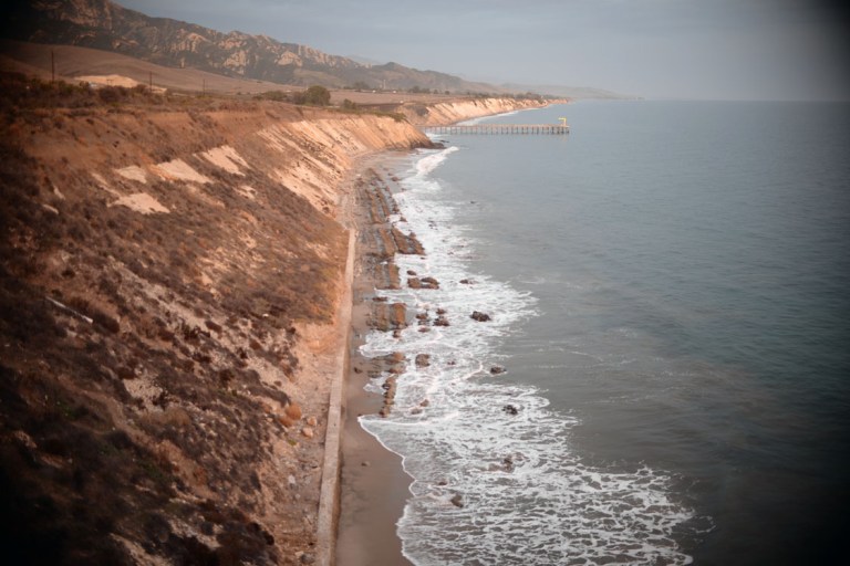
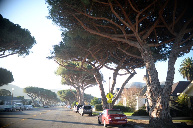
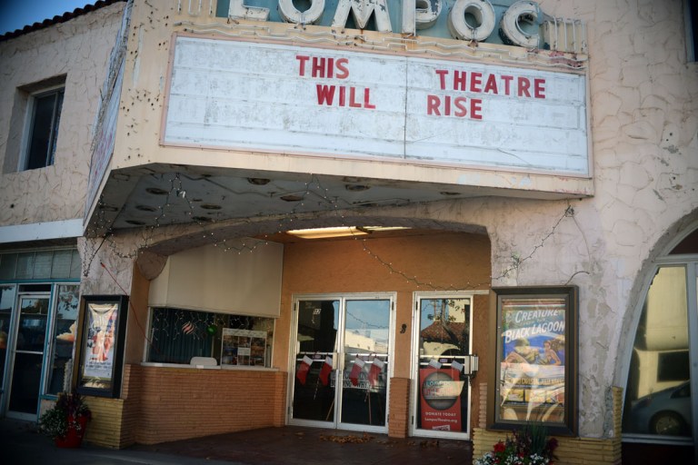
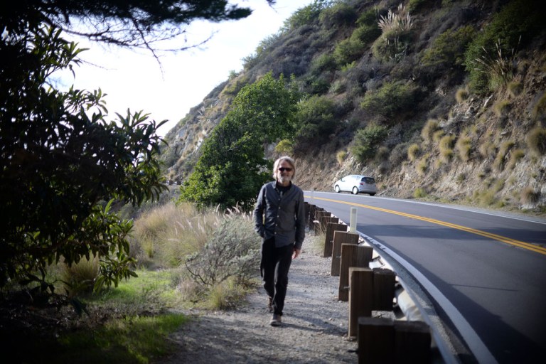
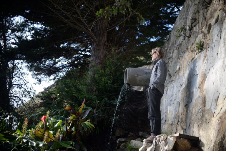
the next day we continued ever onwards and passed through more gorgeous country as we climbed up out of the desert and into ranchita and warner springs and aguanga. there were evergreens and dry grass and live-oaks. it was country i just wanted to lie around in. that night we stayed with a couple of good friends of johns in ojai, and spent much of the next day thrifting before heading to the coast. we were nearing the end of the road trip portion before hitting the bay area, and the land was definitely feeling more populated. we spent the next night on the santa rosa road near lompoc, the next day finding a street lined with stunning stone pines. later that day we stopped at a spring on the big sur coast to fill up our water bottles and marvel at the extensive jade plants growing down the hillside. this was our little bit of shoreline before arriving in the bay area that night.

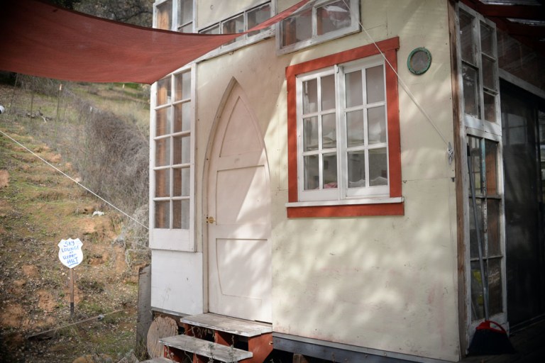
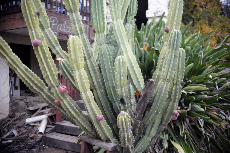


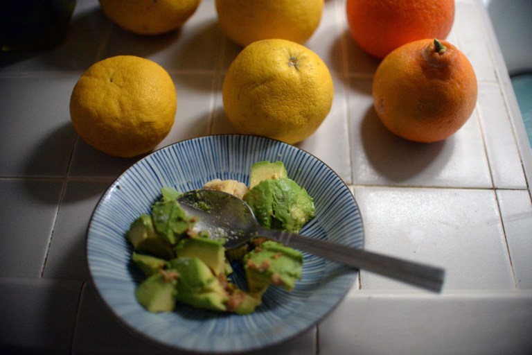
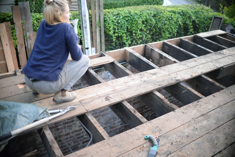
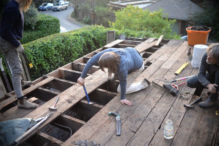
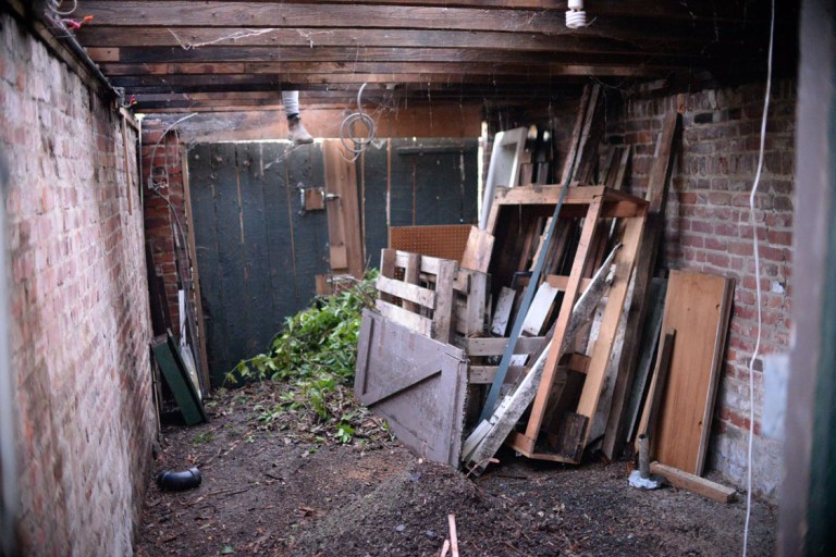
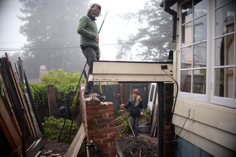
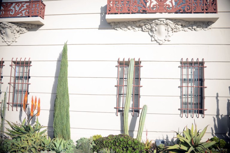
the main purpose of our trip was to do renovations on ellahs house, but we added on the desert rambling to make it more of an adventure. the time in oakland/berkeley was mainly spent on the renos, so there isn’t much to report, although we did begin fermenting the sauerkrauts on our arrival, three different kinds based on our favourites from the road, and all were deliciously successful. my daily joy was the bike ride to/from work. it was all uphill on the way in – taking us a bit less than an hour, and all downhill on the way home – taking about 40 minutes. it had been several years since i had biked in a big city, and oh the joy. it isn’t something i want to do on a regular basis by any means, but i love the thrill of weaving fast through traffic, especially when the cars are at a standstill, and – not knowing the city – the road being new and exciting every time. PLUS, compared to the wee isle, these roads were pavement, a speedy smooth joy of joys. other than the physical delight of biking, it also enabled us to really take in and enjoy the neighbourhoods we were passing through. orange and meyer lemon trees everywhere (and one pomelo!), magnolias in bloom, prickly pears drooping from cacti, towering palm trees, cute little wood-shingled houses… we biked to work on christmas day and the roads were SO quiet, there were more joggers and walkers out than cars, and the sun was bright and low highlighting all of the beauty. a couple of days later we were on the road again…


we only had two more nights together before john turned back south, so we first headed straight north through the interior in order to stop at the rest-area with the olives. after that we beelined it for the coast at the next available opportunity, and spent a rainy day winding up the coastal highway – a nice prelude to the return to the the wet west-coast winter.


it’s been a month and a half since the trip ended and i started writing this post, as a result i have gotten tired of re-reading it and editing it, so i am just putting it out now as is, hoping i didn’t miss any major errors!
*some of these photos are by john
